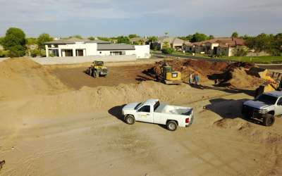
ACS was retained to perform a Subsurface Investigation using Seismic Refraction. So? We perform many of those – what was so exciting about this? The site was located in Hawaii – that’s what!!! To fully understand the extent of our excitement you must realize that we are a geotechnical engineering firm located in Arizona – the desert. It is the end of July the temperatures are 110+ for consecutive months and nature around you comes in shades of brown. And then a job in Hawaii – tropical forests – light breezes from the Sea – beaches and tropical foods! The entire office volunteered!
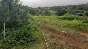
Two E.I.Ts most experienced in Seismic Refraction were the lucky ones to perform the field investigation under direction of one of our Professional Engineers who wrote the report.
Seismic Refraction – what is it anyways?
According to Wikipedia:
Seismic Refraction is a geophysical method used for investigating subsurface ground conditions by utilizing surface sourced seismic waves. Data acquired on site is computer processed and interpreted to produce models of seismic velocity and layer thickness of the subsurface ground structure.
Seismic refraction measures the travel time of the seismic waves down to the top of rock, refracted along the top of rock and its returns to the surface as a head wave along a wave front like the bow wake of a ship (geophysics.biz) It is a soils investigation method that utilizes the refraction of seismic waves on geology layers and rock/soil units to characterize geologic subsurface conditions. Acoustic energy waves are refracted when they cross over between soil/ and or rocks of differing seismic velocities.
The procedure is outlined as follows:
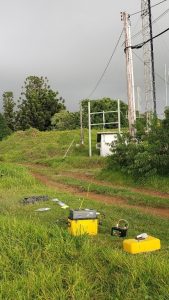 A geophone is inserted into the ground or on a rock surface. Attached to it is a recording device. At predetermined intervals away from the geophone, in a linear array, a heavy sledgehammer strikes a stable plate or rock surface. Typically, the intervals of successive hammer impacts range from five to twenty feet. A timing device attached to the hammer, trips a measured recording sweep time, at the moment of impact. The arrival time of the induced Wave is measured and recorded at each interval. The length of a survey is closely related to the depth of investigation. Generally, the depth of investigation is approximately equal to one-third the length of the survey. For example, if it is desired to examine the substrata to a depth of twenty feet, the survey should extend a distance of at least sixty feet. Changes in the calculated velocity indicate strata breaks or distinct changes within the same stratum. The important concept to remember with this method is that it is predominantly effective where velocities increase from layer to layer, moving downward from the surface. Analytical methods are also available for determining the depth to the various layers, even in the most complex multi-layer situations.
Advantages and Limitations
 This is a non- destructive method of geotechnical investigation and allows to capture data in areas where a drill rig has no access. It also provides more complete information about the extent and complexity of an underlying rock layer.
But it finds its limitations where subsurface layers are thin and where weaker material like soils are underlying stronger materials.
It is best used for investigating unconsolidated layers/soils or depth to bedrock or Water table and soil and rock properties.
In our case the site was within the lava flow and the objective was to determine the depth and strength of the solid strata.